In Old Haggerston

Click here to book for my tours through July, August and September
William Palin recalls the lost wonders of the once coherent and distinctive neighbourhood of Haggerston

Tudor Gothic Villas in Nichols Sq, 1945
Haggerston, in the Borough of Hackney, remains one of those ‘lost’ districts of London’s inner suburbs. Even the boundaries of this elusive locale have fluctuated, yet although the current electoral ward extends deep into Shoreditch, I would draw the borders of Haggerston at Hackney Rd to the south, Queensbridge Rd to the east, Kingsland Rd to the west and Regent’s Canal to the north.
Just a few important public buildings remain in Haggerston, including the old Haggerston Library – which was left to rot in the seventies before being facaded in the nineties – and the magnificent Haggerston Baths on Whiston St with its gilded Golden Hind weather vane. Poignant indicators of the glories that once were here.
Although Haggerston suffered some bomb damage – St Mary’s Church by John Nash was completely destroyed in 1941 – it was the post-war planners who erased most of the superior nineteenth century terraces, with streets of sound houses succumbing to the bulldozers as late as 1978. While the estates that replaced them may have provided superior accommodation and new amenities, they were brutal and uncompromising in their disregard for the intimacy, cohesion, humanity and community spirit of the old streets – attributes embraced in other similar London neighbourhoods wherever the terraces were retained.
As London’s population grew rapidly in the nineteenth century, Haggerston became a densely populated industrial suburb. In many eastern districts, land ownership tended to be fragmented, resulting in a series of relatively small-scale building speculations that eventually came together to form a coherent if quirky network of streets with pubs, shops and small industry, all adding to the diverse character of the streetscape. Although individual speculators – whether a few houses or a whole street – imposed a uniformity of design, there was surprising and delightful variation between streets with even modest houses exhibiting decorative flourishes in their brickwork, fanlights, shutters and front doors. Where streets met, the junctions were resolved with an effortless dexterity which was one of the striking characteristics of the London speculative builder and, on the rare occasion a pub was absent, a corner house was built with a side entrance.
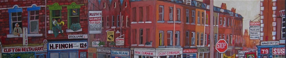
In common with most of south Hackney and Shoreditch, the dominant industries of the area were the furniture and finishing trades. An insurance map of 1930 shows timber yards, French polishers, enamellers, cabinet factories, mirror frame factories, wood carvers and a plethora of other related trades. Interestingly, the legacy of these industries is still evident today in the Hackney Rd, where Maurice Franklin the ninety-three year old wood turner works at The Spindle Shop and D.J.Simons maintain their thriving business supplying mouldings for picture framing after more than a century, as well as in the handful of second hand shops trading in the furniture once made locally.
Unquestionably, the centrepiece of Haggerston’s nineteenth century development was Nichols Sq, situated east of the Geffrye Museum beyond the railway viaduct. Built in 1841 and featuring two outward facing rows of picturesque Tudor gothic villas at its centre, Nichols Sq was further enhanced in 1867-9 by a splendid church and vicarage – St Chad’s – by the architect James Brooks. Surviving in good condition until blighted by a Compulsory Purchase Order, the square was swept away in 1963 for the Fellows Court Estate. Geoffrey Fletcher, author of ‘The London Nobody Knows,’ lamented the impending loss in 1962 by illustrating the houses in the Daily Telegraph, and describing “the delightful Gothic villas … in excellent condition [which] if they were in Chelsea would fetch anything from £10,000 to £15,000.” Savouring the architectural detail, he comments “Typical of the finesse of the period is that, while the terrace railings have a Classic flavour, the similar ones of the cottages have a Tudor outline. But after next year none of this will matter any more.”
The London County Council planning files record no evidence of any robust defence of Nichols Sq. The principal concern – ironic in the context of the current plans to demolish the Marquis of Lansdowne pub – was the effect of the new tower blocks upon the setting of the Geffrye Museum. Nichols Sq had only one entrance, which led from Hackney Rd at the south east corner, and this was guarded by a Tudor lodge. The secluded location had helped it retain an isolated respectability until the very end, despite the incursion of the railway viaduct across its western extremity just a few years after completion.
To the south of Fellows Court Estate is Cremer St, the only direct link between Hackney Rd and Kingsland Rd, which was once graced by a series of modest but elegant semi-detached villas (a building type that became a defining characteristic of Hackney). These villas are captured in a beautiful series of LCC photographs of 1946, which also show a double-fronted detached house with a wide fanlight, where an old man perches on the high front steps, lighting a pipe. In Cremer St, The Flying Scud pub, with its distinctive blue Truman’s livery survived until only a few years ago, while running south from there – now reached via a rubbish-strewn alley – is Long St, whose distinctive yellow brick houses are also illustrated in the LLC old photographs. Of these, only a few paving stones survive.
To the north of the Fellows Court Estate is Dunloe Street, once lined by neat terraces, now bleak save for St Chad’s Church – the last fragment of Nichols Sq. Dunloe St linked into a network of small streets, including Appleby St and Ormsby St, where well-maintained and well-loved terraces endured until 1978 when they were controversially emptied of their occupants and demolished. A handful of houses on the west end of Pearson St are now the only reminders we have of this once vibrant and homogenous neighbourhood.
In 1966, architectural critic Ian Nairn spoke eloquently of the lost opportunities of the rebuilding of the East End, in words that perfectly describe the fate of old Haggerston – “All the raucous, homely places go and are replaced by well-designed estates which would fit a New Town but are hopelessly out of place here. This is a hive of individualists, and the last place to be subjected to this kind of large-scale planning. Fragments survive, and the East Enders are irrepressible …but they could have had so much more, so easily.”

Nichols Sq by Geoffrey Fletcher, 1963

Plan and perspective of Nichols Sq, 1845 – not really a square at all but highly picturesque. (Copyright Hackney Archives Department)

North side of Nichols Sq, 1960.

Washing the doorstep in Shap St with the Fellows Court Estate beyond, 1974. (Copyright Hackney Archives Department)

A rich and coherent cityscape – Shap St, looking north, 1974. (Copyright Hackney Archives Department)

Elegant dark-painted sashes and immaculately maintained shutters in Ormsby St, 1965. (Copyright Hackney Archives Department)

Hows St, c.1960. (Copyright Hackney Archives Department)

Whiston St in the hot summer of 1976, just before demolition. (Copyright Hackney Archives Department)

Intimate streetscape – Ormsby St, 1965. (Copyright Hackney Archives Department)

Weymouth Terrace shortly before demolition, 1964. Note the stuccoed ground floor facade. (Copyright Hackney Archives Department)

Geffrye St, 1960s (Copyright Hackney Archives Department)

“All the homely places have gone”– Sitting room at 50 Shap St c.1959. (Copyright Hackney Archives Department)

Fellows Rd, 1959. Neat terraces with blank panels at parapet level. (Copyright Hackney Archives Department)

A perfect corner, courtesy of the London speculative builder. Pearson St and Fellows St, 1951. (Copyright Hackney Archives Department)

Ormsby St before demolition, 1978 – note the photographer’s blackboard on the window ledge. (City of London, London Metropolitan Archives)

Cremer St, 1946. (City of London, London Metropolitan Archives)

Cremer St, 1946. (City of London, London Metropolitan Archives)

Detail – Man lights a pipe in Cremer St, 1946. (City of London, London Metropolitan Archives)

Cremer St, 1946. (City of London, London Metropolitan Archives)

Tudor Gothic villas in Nichols Sq, 1950. (City of London, London Metropolitan Archives)

Tudor Gothic villas in Nichols Sq with fleur de lis railings, 1950. (City of London, London Metropolitan Archives)

Iain Nairn described the East End as “a hive of individualists” – this applied to the builders too, as shown in the delightfully quirky design of these houses in Long St, photographed in 1951. (City of London, London Metropolitan Archives)

Fine eighteenth century doorcase at 171 Kingsland Road. The house and its neighbours came down in the late sixties. (City of London, London Metropolitan Archives)


It makes me sick to think that such a quirky and beautiful place was demolished.
Such a terrible waste all them beautiful buildings knocked down for tower blocks.my grandad and great grandad lived in dunloe St and Pearson St.
It was so sad seeing the photographs of these wonderful streets. It is hard to think how on earth the developers justified pulling them down. We lived in a similar street in Hackney that thankfully escaped demolition.
It is sad to see how (also in our country, by the way) historical, remaining architecture is treated. There is indeed the Heritage Protection Authority (where I once did my civilian service), but in the end, money always has the bigger power…
Love & Peace
ACHIM
Look how clean these streets are and No Vehicles. Amazing.
Even after almost after 90 years it annoys me intensely to see, as in these images, how uneven the collection of garden railings was. Here they survived the war. But not so far away, up Kingsland Road in the Amhurst/Evering Road area, they were savagely collected for scrap. In Bayston Road we lost our front garden gate and all that served to separate one plot from the neeighbour’s on all sides. No explanation was ever forthcoming; it depemded on the whim of the collecting squads, apparently.
My late elderly neighbours used to say how handsome houses were demolished for the urban sprawl that is Fellows Court. Planners and Central/local governments were no doubt going for the cheap quick developments in Post War Britain.
Similar ugly glass steel and concrete private estates being over developed all over the capital for the last decade. Not many will be a lasting tribute to building and design, but more blots on our landscape.
Lovely streetscapes with a distinct lack of motor vehicles even in the 1970s pics. Oh, what London has had snatched away from her by her power hungry overlords.
Whenever I visit the East End, I do check on Google Maps to see which buildings my ancestors are associated with are still standing. Not very many! Sometimes I find little gems. You do wonder what goes through the minds of planning departments when they approve monstrosities and destroy history.
Which brings me back to the Whitechapel Bell Foundry. This is our history and it belongs to all of us. See also Truman Brewery.
It breaks my heart. I know the area well, having been brought up in Bethnal Green. We used to drink in pubs such as the Flying Scud.
All gone now.
Haggerston was where I lived until demolition of my terraced house in Fellows Street. My family had lived there since the 1870s and now unfortunately not a lot survives. The wonderful. Randal Cremer school is still there in Pearson street but is destined for closure because of falling numbers of children. Take a look at house prices there now and it tells its own story
..of course the squalid slums had to go, but so sad that these authentic characterful buildings are no more – such a loss to London’s architectural historic landmarks :/
Truly tragic. These houses could have been renovated so easily. A failure of imagination and the pressures coming from urban planners and large scale building contractors stole the heart from Haggerston.
I am reminded of Col, the grumpy pub landlord, in Sarah Wimman’s wonderful novel Still Life , set partly in Haggerston, holding out against the wrecking ball. He would not be successful, although the novel doesn’t tell us that, but his attempt encapsulated hope and the spirit of community that was stolen away in the name of progress.
I went to school in Kingsland Road and know the area very well as many of my school friends lived there. There were some truly beautiful villas, albeit in need of some TLC.
It’s tragic what has happened in Haggerston and in some other parts of Hackney.
Dear god, if a god there be. After seeing this, I have even less reason to think so. Ghastley.
Jarvis Family shop and home on corner of Pearson Street for over 40 years and finally demolished, holding so many family stories and memories.
East End of London group, then click Nichols Square. Christine Swan think you lived next
door to me. I have put photos on there as there is nowhere to put them on here
Haggerston does have a natural boundary further to the North. The now lost River Pigwell was the natural boundary separating Dalston to the West and Haggerston to the East. The river would have run across from Arbutus Street through Stonebridge Gardens and across the garden of All Saints Haggerston Church (down Graham Road and eventually joining the River Lea). The local name Stonebridge (Stonebridge Estate, Stonebridge Common and Stonebridge Gardens) comes from a Stone Bridge that used to take you fom Haggerston to Dalston situated near where the Church is now. The river was dried when the canal was constructed but the river bed remains under ground.