Along The Black Path

Sculpture of porters resting at London Fields
Taking to heart the observation by the celebrated poet & resident of Aldgate, Geoffrey Chaucer, that April is the time to go on pilgrimages, I set out last week for day’s walk in the sunshine along the ancient Black Path from Walthamstow to Shoreditch. The route of this primeval footpath is still clearly visible upon the map of the East End today, as if someone had taken a crayon and scrawled a curved diagonal line across the grid of the modern street plan. There is no formal map of the Black Path yet any keen walker with a sense of direction may follow it as I did.
Tracing a trajectory running northeast and southwest between Shoreditch Church and the crossing of the River Lea at Clapton, the Black Path links with Old St in one direction and extends beyond Walthamstow in the other. Sometimes called the Porter’s Way, this was the route cattle were driven to Smithfield and the path used by smallholders taking produce to Spitalfields Market. Sometimes also called the Templars’ Way, it links the thirteenth century St Augustine’s Tower on land once owned by Knights Templar in Hackney with the Priory of St John in Clerkenwell where they had their headquarters. No-one knows how old the Black Path is or why it has this name, but it once traversed open country before the roads existed. These days the path is black because it has a covering of asphalt.
On the warmest day of spring I took the train from Liverpool St Station up to Walthamstow to commence my walk, seeking respite in the sunshine after the harsh winter that outstayed its allotted season. In observance of custom, I commenced my pilgrimage at an inn, setting out from The Bell and following the winding road through Walthamstow to the market. A tavern by this name has stood at Bell Corner for centuries and the street that leads southwest from it, once known as Green Leaf Lane, reveals its ancient origin in its curves that trace the contours of the land.
Struggling to resist the delights of pie & mash and magnificent 99p shops, I felt like Bunyan’s pilgrim avoiding the temptations of Vanity Fair as I wandered through Walthamstow Market which extends for a mile down the High St to St James, gradually sloping away down towards the marshes. Here I turned left onto St James St itself before following Station Rd and then weaving southwest through late nineteenth century terraces, sprawling over the incline, to emerge at the level of the Walthamstow Marshes.
Then I walked along Markhouse Avenue which leads into Argall Industrial Estate, traversed by a narrow footpath enclosed with high steel fences on each side. Here you may find Allied Bakeries, Bates Laundry and evangelical churches including Deliverance Outreach Mission, Praise Harvest Community Church, Celestial Church of Christ, Mountain of Fire & Miracle Ministries and Christ United Ministries, revealing that religion may be counted as an industry in this location.
Crossing an old railway bridge and a broad tributary of the River Lea brought me onto the Leyton Marshes where I was surrounded by leaves unfurling, buds popping and blossom exploding – natural wonders that characterise the rush of spring at this sublime moment of the year. Horses graze on the marshes and the dense blackthorn hedge which lines the footpath provided a sufficiently bucolic background to evoke a sense that I was walking an ancient footpath through a rural landscape. Yet already the municipal parks department were out, unable to resist taking advantage of the sunlight to give the verges a fierce trim with their mechanical mower even before the the plants have properly sprouted.
It was a surprise to find myself amidst the busy traffic again as I crossed the Lea Bridge and found myself back in the East End, of which the River Lea is its eastern boundary. The position of this crossing – once a ford, then a ferry and finally a bridge – defines the route of the Black Path, tracing a line due southwest from here.
I followed the diagonal path bisecting the well-kept lawn of Millfields and walked up Powerscroft Rd to arrive in the heart of Hackney at St Augustine’s Tower, built in 1292 and a major landmark upon my route. Yet I did not want to absorb the chaos of this crossroads where so many routes meet at the top of Mare St, instead I walked quickly past the Town Hall and picked up the quiet footpath next to the museum known as Hackney Grove. This byway has always fascinated me, leading under the railway line to emerge onto London Fields.
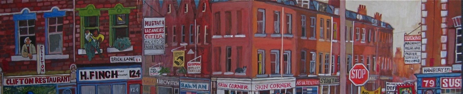
The drovers once could graze their cattle, sheep and geese overnight on this common land before setting off at dawn for Smithfield Market, a practice recalled today in the names of Sheep Lane and the Cat & Mutton pub. The curve of Broadway Market leading through Goldsmith’s Row down to Columbia Rd reveals its origin as a cattle track. From the west end of Columbia Rd, it was a short walk along Virginia Rd on the northern side of the Boundary Estate to arrive at my destination, Shoreditch Church.
If I chose to follow ancient pathways further, I could have walked west along Old St towards Bath, north up the Kingsland Rd to York, east along the Roman Rd towards Colchester or south down Bishopsgate to the City of London. But flushed and footweary after my six mile hike in the heat of the sun, I was grateful to return home to Spitalfields and put my feet up in the shade of the house. For millennia, when it was the sole route, countless numbers travelled along the old Black Path from Walthamstow to Shoreditch, but last week there was just me on my solitary pilgrimage.

At Bell Corner, Walthamstow

‘Fellowship is Life’


Two quinces for £1.50 in Walthamstow Market

Walthamstow Market is a mile long

At St James St

Station Rd


‘leaves unfurling, buds popping and blossom exploding which characterise the rush of spring’

Enclosed path through Argall Industrial Estate skirting Allied Bakeries

Argall Avenue

‘These days the path is black because it has a covering of asphalt’

Railway bridge leading to the Leyton marshes


A tributary of the River Lea

Horses graze on the Leyton marshes

“dense blackthorn which line the footpath provided a sufficiently bucolic background to evoke a sense that I was walking an ancient footpath”

‘the municipal parks department were out, unable to resist taking advantage of the sunlight to give the verges a fierce trim with their mechanical mower even before the the plants have properly sprouted’

The River Lea is the eastern boundary of the East End

Across Millfields Park towards Powerscroft Rd

Thirteenth century St Augustine’s Tower in Hackney

Worn steps in Hackney Grove

In London Fields

At Cat & Mutton Bridge, Broadway Market

Columbia Rd

St Leonard’s Church, Shoreditch
You may also like to read about


Not like me to be a pedant but the waterway you crossed before the riding stables is the flood relief channel built in the 1950s.
One reason for the name could be the droppings left behind by the animals being driven along the path.