In Search Of The Civil War In London

At the site of the Civil War fort in Shoreditch
Very little survives today of the fortifications constructed to defend London in the English Civil War. Yet there is evidence to be found if you know where to look. So Contributing Cartographer Adam Dant & I set out to walk the route of the wall built by the Parliamentarians from Wapping to Westminster in 1642/3 to see what we could discover, as part of Adam’s research for a map he is planning of London in the Civil War.
In the autumn of 1642, Londoners blocked streets with barricades, posts and chains to defend their city. Over the next year, this evolved into eighteen kilometres of ramparts and ditches surrounding the capital, linking twenty forts containing around two hundred cannon. As many as 100,000 worked on digging the ditches and building up the ramparts with entire trades suspending their usual work for the duration.
A bank and ditch extended from Wapping up to Whitechapel where the excess earth was piled up in a mound that sat there until the eighteenth century when it was used to fill the ditch in again, which became Cannon St Rd and New Rd. Mount Terrace next to the Royal London Hospital takes its name from this and, off Commercial St, you will still find Rampart St and Flintlock Close recalling this era.
It was a bright summer’s morning as Adam Dant and I set off from Wapping New Stairs with George Vertue’s plan of the defences in hand. It is the best record we have but – as it was drawn almost a century later in 1738 – it may not be entirely accurate. As a guide, we carried the writing of William Lithgow, a Lanarkshire tailor who wrote an account of the defences in May 1643. “I have never seen a larger inveloped compasse within the whole universe,” he wondered.
As Adam & I ambled from Whitechapel through Spitalfields, I thought of Nicholas Culpeper the herbalist who lived in Red Lion House where Puma Court is today. In 1642, he was summoned by Oliver Cromwell to serve on the front line at Edgehill as Surgeon General.
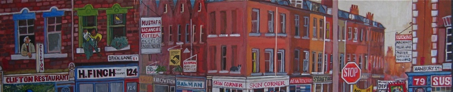
In Shoreditch, the defences stood just north of St Leonard’s Church with a gateway at the foot of the Kingsland Rd. Today ‘The Conquerer,’ a former pub in Boundary St, is adorned with a painting of a Roundhead soldier which cannot be a co-incidence.
We set off westward following the line of the defences which ran in parallel but fifty yards north of Old St. The only evidence we found is in the name of Mount Mills off Goswell Rd, where the remains of seventeenth century windmills were recently excavated. From here, we followed the line of the wall and ditch until we reached Exmouth Market, teeming with office workers lining up for takeaway lunches. Here we took a brief detour, walking up Amwell St, uphill to Claremont Sq where a reservoir makes a convenient stand-in for Fort Royal, from which Wenceslas Hollar drew the view towards the city in 1644.
Retracing our steps to Exmouth Market and crossing Mount Pleasant, we traced the line of defences across Bloomsbury without finding any sign of their existence until we reached Bedford Sq. Southampton Fort stood here more than four centuries ago and the dramatic geometry of the square today evokes a military fortification without a huge leap of imagination.
In Fitzrovia, only the presence of Eastcastle St reassured us that we were still on the right track but, as we turned south west through Mayfair we came into Mount St, referring to a Civil War bulwark that stood here, known as ‘Oliver’s Mount.’ It was mid-afternoon when we arrived in Hyde Park where the remains of Civil War earthworks are still visible parallel to Park Lane. For as along as I have known the Park, I assumed these long mounds were recent landscaping to shield traffic noise, yet these inauspicious lumps in the grass actually date from when Park Lane was Tiburn Lane and the Tiburn river flowed through here, and this was the front line of the defence of London.
There is a certain irony that the west wall of Buckingham Palace garden follows the line of the Parliamentarian defences, protecting our monarch where once this line was protection against the Royalist forces. From Victoria, the ditch and wall ran down the river at Vauxhall and traversed the south bank to Southwark. But we wandered through the back streets around Vincent Sq towards Westminster, taking a short cut through Dean’s Yard to emerge in front of the Abbey.
Weary, foot-sore and thirsty, Adam & I arrived in Whitehall where Oliver Cromwell still presides over Parliament and – at respectable distance – a bust of Charles I at the Banqueting House commemorates the location of his execution. Across the road at Horseguards, the number ten on the clockface is painted black to indicate the hour when the axe fell and our nation’s history changed forever.
It was a long walk that Adam & I undertook on a warm day in the footsteps of John Lithgow through the dusty crowded streets and, in Westminster, we were confronted with the turbulence of our contemporary politics. Yet we were grateful that the journey we had taken through London in the Civil War granted a certain perspective which restored a necessary sense of proportion in the current crisis.
If readers are aware of other evidence of the Civil War visible today in London please let us know so Adam Dant can include it on his map.

George Vertue’s Plan of the Defences, published in 1738 (click to enlarge)

Wapping New Stairs, where the defences met the Thames

The line of the defences ran northward from Wapping to Whitechapel

Rampart St runs parallel to New Rd in Whitechapel

Off Commercial Rd

The Whitechapel Mound in the eighteenth century

Mount Terrace in Whitechapel, where they piled up the earth from digging the ramparts
“Advancing thence along the trench dyke which runneth through Wappine fields to the further end of White-chappell, a great way without Aldgate, and on the road to Essex, I saw a nine-angled fort, only pallosaded and single ditched, and planted with seven pieces of brazen ordinance.” William Lithgow 1643

Herbalist Nicholas Culpeper was summoned from Red Lion House in Spitalfields by Oliver Cromwell to be Surgeon General on the front line during the Civil War

The gate at Shoreditch looking south towards St Leonards Church

The same view today

St Clements Church and King’s Sq gardens, north of Old St, on the line of the defences

Mount Mills off Goswell Rd records the site of Mount Mills Fort
“Standing on the highway near to the Red Bull, this is a large and singular fortification, having a fort above, and within a fort. The lowest consisting of five angles, two whereof towards the fields are each of them thrice parted, having as many great cannon, with a flanking piece from a hid corner, the upper fort standing circular is furnished with eleven pieces of cannon” William Lithgow 1643

Mount Mills Fort from a broadside of 1643

Northampton Sq on the line of the defences

This reservoir in Claremont Sq occupies the site of Fort Royal
” Continuing to Islington-hill, where there is erected a most rare and most admirable fortification called Strawes Fort, but now Fort Royall. It hath eight angles and a spacious interlading distance between each of the cornered bulwarkes. This fort is marvellous persicuous and prospective both for city and country, commanding all the other inferior fortifications near and about that part of the enclining ground.” William Lithgow 1643

Wenceslas Hollar’s drawing of the view south towards the City from Fort Royal c.1644

Great Ormond St on the line of the defences

Southampton Fort stood north of Bedford Sq
“Consisting of two divided bulwarks, and each of them garnished with four demi-culverines of brasse with the intervening distance fortified. The two former bodies are pallosaded, double-ditched, and the middle division whereof barricaded with stakes a yard high and each of them hooked up with three counter thwarting pike of iron.” William Lithgow 1643

Eastcastle St north of Oxford St

Mount St in Mayfair on the line of defences

These mounds running parallel to Park Lane are vestigial remains of Civil War earthworks

John Roque’s map of 1746 records the earthworks in Hyde Park

The western wall of Buckingham Palace garden follows the line of Civil War defences

Adam Dant consults his notes in Grosvenor Gardens

Vincent Sq on the line of the defences

Oliver Cromwell presides outside the Houses of Parliament in Westminster

Charles I commemorated at the Banqueting House in Whitehall
")
Print of the execution, 1649 (reproduced courtesy of British Museum)

At Horseguards, the number ten on the clock is permanently marked in black in remembrance of the hour of the time of the execution of Charles I
We are indebted to the scholarship of David Flintham in preparing this feature
You may also like to read about


Many thanks. Clearly London was not going to be exempt from the tragedies of the Civil War, but I assumed the physical evidence no longer existed. That the defensive system of the city “evolved into eighteen kilometres of ramparts and ditches surrounding the capital, linking twenty forts containing around two hundred cannon” is amazing. I absolutely believe that 100,000 worked on digging the ditches and building up the ramparts, but I hadn’t seen evidence of it in the Civil War history books.
Yes the mounds running parallel to Park Lane might well be vestigial remains of Civil War earthworks, but unless there is some sort of plaque there, I wouldn’t have noticed any connection. Ditto a wall of Buckingham Palace garden that follows the line of Civil War defences
What an absolute pleasure to read this account on a wet Sunday morning up North.
The sun was virtually shining upon me from my iPad as I followed the Gentle Author and Mr Dant on a perambulation I could never undertake in reality.
To see the shades of the Civil War still present in our Capital today. I actually marvelled that the odd characters we saw caught on their business seemed totally oblivious that they were following paths once lined with troops and cannon and “thwarting pikes” a handful of centuries ago. I almost expected them to be momentarily paused, puzzling on the crash and clatter of iron and steel about them, the past seeming so close to the present.
Once more, Gentle Author has transported a reader to bygone days, not gone but just standing quietly in the leafy shadows of London, waiting to be noticed
Thank you so much.
Your blog is always interesting at the very least but this is one of the outstanding ones, absolutely fascinating.
Thank you so much Gentle Author and your colleagues Adam and David, not just for the history and archaeology but also, as you say, for a most necessary sense of proportion during our current circumstances.
Best wishes to you all.
Yes – agreed – a really interesting blog and one that really ought the reality of being in a civil war to life. I hadn’t thought about having to have such major defences (I just vaguely remember being told that London mostly sided with Cromwell).
At least we haven’t got to the rampart building stage in today’s troubled times…
Another great piece of writing .
I hadn’t even considered that London would have made preparations to defend itself during the civil war.
I used to frequent The Conqueror pub back in the eighties , I just assumed it was named after William . You learn something new every day.
Thank you, Gentle Author.
Absolutely fascinating, I had no idea that shadows of the Civil War could still be found in London today!
I’ve been taken back down the vista of years by the GA, Adam and David, thank you for sharing this treasure trove of information.
Outstanding article. You’re outdoing yourself lately, G.A.
I don’t think this is in the text, but Tompion Street (sign pictured next to Northampton Square) presumably reflects the tompions: ‘A block of wood fitting into the muzzle of a gun, and serving to exclude rain, sea-water’ that would have been attached to the cannon.
Its interesting how the line traverses through London from Whitechapel to Mayfair both rich and poor did not want the king. Will London ever see the likes of this again?.
Thank you for revealing this little known aspect of those historic times.
An amazing walk to undertake all in one day! Thank you GA on two counts: l’ve recently trekked on history walks to most of the places you mentioned and picture, but only one section of docklands, the river banks or the city at onetime was sufficient without keeling over into Ye Olde Pub by 3pm.
Your research with your sturdy ‘partners in crime’ is astounding.
Although any execution is gory, the artist’s graphic “spurts” were very curious, as well as the female in the foreground who was either fainting or having a baby.
Most of all your photos turned up the very day after the boy in the EE shop accidentally wiped all my own stunning photos of my very recent London walks from my new phone before l’d backed them up. He phoned today requesting l go in to see if we can retract them from ether, but l think not
Therefore your timely email with apt photos today cheered my desolation no end.
Well done.
Gentlemen , Many thanks a great article of my normal haunts that over time the human mind dilutes the historical significance (shame on me guess familiarly breeds since but not all contempt!) . I particularly liked the reference of today , truly classic = Yet we were grateful that the journey we had taken through London in the Civil War granted a certain perspective which restored a necessary sense of proportion in the current crisis. N
What a brilliant, well-researched , wonderfully illustrated piece of history today.
Thank you for an extremely interesting and insightful article. How many times have I walked up Mount Street and never thought about it having anything to do with the English Civul War Nor did I realise that the English created such barricades the type of which I thought was reserved for Victor Hugo and ‘Les Miserables”.
Wonderful read. Thanks.
Fascinating piece: have never noticed the blackened 10 on Horseguards clock – thank you for highlighting that & the mounds in the Park. I particularly relished the historic images; where did you source them from & was it easy ?
What a feast of information and wonder! Thank you all so much; I had no idea. It’s great to have a contributing cartographer and historian on board. Wouldn’t the measurements of the fortifications have been in miles or even chains and furlongs rather than kilometres? No matter. It is so exciting to have the street names brought to life again – Cannon St Road, Rampart Street, Mount Street. And I’ll take another look at those mounds in Hyde Park when I’m next there. By the way, who is the soldier in Grosvenor Gardens studiously avoiding eye contact with Adam just as Adam is studiously ignoring him, and what uniform is he dressed in?
What an adventure! What an extraordinary telling of an historical event so few are aware of. It will give a completely new perspective when visiting these sites in future. As the citadel of Remainers perhaps we Londoners should all get our shovels out and emulate our revolutionary forefathers?
A brilliant piece. Thank you.
Great article TGA, I was just wondering if ‘Newington Butts which runs Borough Road to the Elephant and Castle is a diminutive of ‘Newington Buttresses’. The maps says ‘To Newington’ and the defences are in exactly the right spot.
“What have they done, or left undone,
That might advance the Cause at London?
March’d rank and file, with drum and ensign,
T’entrench the city for defence in;
Rais’d rampires with their own soft hands,
To put the enemy to stands;
From ladies down to oyster-wenches
Labour’d like pioneers in trenches,
Fell to their pick-axes and tools,
And help’d the men to dig like moles?”
From Samuel Butler’s Hudibras
I got as far as Shoreditch when I tried the same walk…. Then the skies opened!..
Great article but one correction: the black dot is at 2 on the Horseguards Parade clock, not 10! (The 10 certainly refers to 10 minutes past the hour)
I’ve known about this for some time, but could never square the line that it took after leaving the river at Wapping.
What threw me was the presence on various old maps of a thoroughfare (?) named King David’s Fort, which I had assumed (wrongly) must have formed part of this battlement.
All clear now, though, thanks to your research.
Also, having lived in the area around “RAMPART Street” for 60+ years, how did I not make the connection?