A Brief History Of Bishopsgate Goodsyard

Mesolithic tranchet adze discovered at Bishopsgate Goodsyard

Bishopsgate Goodsyard c.1910
There are many continuities that run through time in Spitalfields, yet the most disturbing is the history of brutal change which has been wreaked upon the neighbourhood over centuries.
The Hospital of the Priory of St Mary – from which the name Spitalfields is derived – was established in the eleventh century as a refuge for the homeless, conveniently one mile north from the City of London which sought to expel vagabond and beggars. Then Henry VIII destroyed this Priory in the sixteenth century and seized the ‘Spital fields which he turned over to usage as his Artillery Ground.
In the eighteen-thirties, the Eastern Counties Railway, cut across the north of Spitalfields to construct Bishopsgate Station on Shoreditch High St, pushing families from their homes to seek new accommodation in the surrounding streets. The overcrowded area to the north became known as the Nichol, notorious for criminality. While to the south, in the courtyards beyond Quaker St, old houses built when the silk industry thrived in Spitalfields were rented out at one family per room. Clusters of black streets on Charles Booth’s Descriptive Map of London Poverty vividly illustrate the social consequences of this drastic redevelopment.
The situation was exacerbated in Spitalfields when the City of London objected to traffic from the London Docks congesting their streets and hundreds more homes were demolished when Commercial St was cut through to carry goods directly to the terminus in Shoreditch High St. Finally, in the eighteen-seventies when the railway was extended south to Liverpool St, an entire residential neighbourhood area to the west of Spitalfields was also obliterated.
It was only at the very end of the nineteenth century, when the Boundary Estate was constructed as Britain’s first social housing, that any attempt was made to ameliorate the human damage of this unbridled series of large-scale developments. Upon the cusp of the next imminent wave of violent change, in which tall towers threaten to put the Boundary Estate into permanent shadow, it is sobering to contemplate the earlier history of the area that is now known as the Bishopsgate Goodsyard.
The paradox of redevelopment is that it confronts us with our past, when excavations for new buildings uncover evidence of history – such as the Bishop’s Sq development that resurrected thousands of plague victims in Spitalfields. In Shoreditch, exploratory work for a proposed forty storey tower has uncovered the Shakespearian theatre where Henry V was first performed and, at the Bishopsgate Goodsyard, preparatory demolition drew attention to John Braithwaite’s elegant viaduct constructed in the eighteen-thirties. In both cases, the outcome is an unholy yoking of conservation and shopping, with Shakespeare’s theatre due to become a heritage feature in a mall and the Braithwaite’s arches set to provide retail units for brands, and both serving as undercrofts to gargantuan towers.
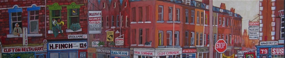
Recent excavations by Museum of London Archaeology Service discovered more than seventy pieces of Mesolithic struck flint, mostly to the west of the Bishopsgate Goodsyard site, suggesting early human occupation towards the banks of the River Walbrook. Ermine St, the Roman road north from the City of London followed the line of Bishopsgate and Shoreditch High St, and burials of this era have been uncovered upon either side of the roadway, just as along the Appian Way in Rome. While a medieval settlement grew up along Shoreditch High St and around Holywell Priory, the land further to the east lay open until the mid-seventeenth century. Yet prior to this, the brick quarries that gave the name to Brick Lane existed there as early as the fourteenth century.
Between 1652 and 1682, the Bishopsgate Goodsyard site was quickly built over a with a mixture of dwellings and small trades as the city expanded. The brick quarries that created the materials for development were eventually filled in with debris from the Fire of London, as streets were laid out and prosperous middle class suburban dwellings were constructed – coinciding with the rise of the lucrative silk industry locally. Discovery of delft tiles, marbles, wine bottles and clay pipes testify to the domestic life of the residents of this newly-built neighbourhood, while analysis of cesspits tells us they ate duck, chicken, mutton, herring, plaice, flounder and cod. Evidence of small-scale industry reveals the presence of sugar processing, glass and iron working, pottery, distillation and the textile trade.
Thus a whole world grew up with streets and yards, taverns, shops, warehouses and workshops – one that was wiped away nearly two centuries later. Today, it is too easy to look at the empty site of the former Bishopsgate Goodsyard and assume that there was never anything before the railway came through. Yet, as we contemplate the next wave of redevelopment, we should do well to contemplate the society that once flourished in this place and how the previous development erased it, that we may draw lessons from the long-term destructive outcomes of these great impositions upon Spitalfields.
 Saxon antler and bone comb discovered at Holywell

Excavation of a brick quarry at the Bishopsgate Goods Yard, close to Brick Lane

On Faithorne & Newcourt’s map of 1658, the site of the Bishopsgate Goodsyard is open fields

By Morgan’s map of 1682, suburban development has filled the site

Pipe bowl depicting Admiral Vernon, who introduced the daily ration of grog to the navy

Pipe bowl depicting Don Blas de Leso, Portuguese governor of Panama kneeling in surrender to Admiral Vernon

Eighteenth century marbles from the Goodsyard

Eighteenth century tin-glazed tile made in London

Mid-seventeenth century Dutch tin-glazed tiles from Bishopsgate Goodsyard, showing a mounted military figure and a man with a cockerel

Eighteenth century tin-glazed tile made in London

Eighteenth century Dutch tile of crucifixion scene

Witch box – animal bones in a wooden box concealed in an eighteenth-century fireplace upon the Bishopsgate Goodsyard site

Unusual post-medieval bone crucifix with sun above, discovered at Bishopsgate Goodsyard, possibly the work of a Napoleonic prisoner of war
 Copper plate inscribed ‘Thos Juchau Shoreditch’ – Juchau was a celebrated bare-knuckle boxer born in 1739, said to have been the ‘hero of a hundred fights,’ who became British champion until defeated by William ‘the dyer’ Darts of Spitalfields in the first ever outdoor heavyweight boxing match in 1777. He died in Bateman’s Row in 1806.
")
Bishopsgate Station, photograph courtesy of National Rail Museum

Charles Booth’s Descriptive Map of London Poverty 1889 courtesy of LSE Library

“The Arches – a long street under a railway which carried the mainline to Liverpool St Station and ran from Commercial St to Club Row … there the pros would practise to mouth-organ acompaniment, night after night, until they had copied the Yanks most intricate steps.” Bud Flanagan, My Crazy Life 1961
Archaeological photographs copyright © MOLA
‘Tracks Through Time, Archaeology and History from the London Overground East London Line’ is available from Museum of London Shop
You may also like to read about


Dear Gentle Author, you have done it again ! What an eye opener. You hit the nail on the head when you wrote how easy it is to just assume that nothing was there before the railway came along. How many times have I sat on a train heading into Liverpool Street station without a thought in my mind except getting a coffee before heading off to work for the day? Gentle Author , you are like our very own time machine, thank you, Lynne 🙂
Most fascinating !
Love & Peace
ACHIM
Bishopsgate Goods Station was, of course, enlarged from the original passenger terminus on the same site.
It is of railway historical interest, as the first (main line) electro-pneumatic signalling system, installed in January 1899, for operating all the freight trains in the station & out towards the main line at Bethnal Green West Junction.
Like the station, this survived, until the disastrous fire of 5th December 1964.
See also Subterranea Britannica on the subject.
Fascinating and interesting, it must have taken a lot of time and effort to construct – thank you.
Hi Greg, the passenger terminus you mention, would that be the disused platform you can see through the arches as you come into Liverpool St Station?
Lynne Ellis
The passenger terminus was closed when Liverpool Street station opened and was converted into the Goods station,the platforms you see from the train are built on the “new” lines to Liverpool Street,and were lso called Bishopsgate…confusing,I know….for the history,see
http://www.subbrit.org.uk/sb-sites/sites/b/bishopsgate_goods_station/index.shtml
Fascinating as ever! The streets on Booth’s map just to the North of the lines out of the yard (Sclater Street, Bacon Street, Swan Street etc ) were owned by Joseph Merceron, the ‘Boss of Bethnal Green’. As early as the 1830s they were already well-known slums, home to cholera and typhus.
Riveting, as ever. It makes me weep to see what we destroy time and time again. I was also surprised and delighted to see the items relating to my ancestor, ‘Old Grog’ aka Admiral Vernon!
Thank you – a brief but incisive history of an area where my ancestors lived. It gives me some insight about what their lives may have been like. The illustrations add greatly to the account.
I remember that when drifting off to sleep , as a child, I could hear the sounds coming from the goodsyard; the squeals and buffeting of the shunting that rang out, that went on-probably through the night, until the early hours. The special delivery vehicles which conveyed their loads to the railyard were, I think, called ‘Scammel’ trucks. They had one wheel in the front (a la Reliant Robin) which facilitated small turning circles. I was always curious to know what all the hubbub and activity that went on in that yard was about, but I never got to see. There were lots of uniformed porters and suchlike wandering about – no place for a child.
Fascinating, thank you.
Thoughtful and thought-provoking. You’ve sifted through so many layers to provide us with a wealth of interesting stuff, sociological and visual. Thanks.
And Bishopsgate (Low Level) – the platforms on the Northernmost two tracks, didn’t last that long ….
Opened: 14.11.1872
Closed: 22.5.1916
Not-quite 44 years, in fact.
Yes the trucks were Scammel- a three wheel traction unit with a single headlight and horse head trademark. Scammel had a depot in Fashion Street where they possibly assembled them. I can vividly recall seeing foreign ‘Frigo’ refrigerated goods rolling stock on the black railway viaduct that ran parallel with Quaker Street. Little did I know back then that whole goods trains used to travel across the North Sea between Harwich and Zebrugge. The move of the Great Eastern Railway passenger terminus from Bishopsgate to Liverpool Street involved considerable civil engineering challenges:- a subterranean approach into Liverpool Street with an acute bend under Commercial Street as well as the need to underpin the North London Railway viaducts on the approach into Broad Street Station. The disused platforms that can be seen on the approach into London were used for a short time after the completion of Liverpool Street Station as a convenience for passengers that didn’t want to go all the way into the City. There was also a connection to the East London Railway just outside of the Pedley Street Station. The tracks have been removed, but in years gone by there were services (usually excursions) that ran from Liverpool Street down to the south coast.
So very interesting, more please.
A wonderful evocative and enlightening account. Thank you so much for giving me such excellent information about the area where my husband’s family once resided. They were French Huguenots and lived in Swan Yard which was demolished for the building of the goodsyard.
I’ve looked at all kinds of old photographs and plans for the Bishopsgate Goods Yard. This is the best one I’ve been able to find, but there is still detail left off given the resizing of whatever this document was:
https://media.subbrit.org.uk/10295/1563201502-bishopsgate-goods-yard-plan.jpg
I had a few questions I was hoping you could help me with.
1. How many full levels at-and-above ground were there, exactly? Were there any mezzanines that make this difficult to define? And lastly, any full or partial basements? It appears today that are two levels at or above ground, but I’ve often seen it described that the burned-down warehouse was a third level?
2. Related to the cross-section of this thing, where exactly where the four platforms for the low-level station? I’ve been able to locate the one off Quaker Street on the south side of the ditch east of Quaker using bing and google earth. But there doesn’t look to be any trace of the ones shown on the map west of Wheeler under Commercial Street. More than that, other websites mention that the low-level platforms were “under” the station and accessible from this “under,” though I’ve never seen any kind of direct access shown from within the Goods Yard, itself, to the platforms in the cut/ditch.
3. Coming in from the east, there appears to be a rail line that splits off to the north on the diagram posted, and travels under the Goods Yard. What is this line? It seems like it’d be strange to show it on the ground floor plan under the station if it didn’t interact with the station. I’d originally thought this could have been where at least two of the low-level platforms are, but that doesn’t seem to be the case.
This is the best account of the disastrous fire in 1964 that I’ve found so far:
https://beyondtheflamesandmore.home.blog/tag/firemen/
Above URL should take you direct to the article but if not, search site for ‘The Bishopsgate Goods depot blaze. December 5th 1964’.